Site contractors often visualize in the vertical but work in the horizontal. Translating between the two has always been a challenge in earthmoving.
Drones and mapping software like HCSS Aerial have made it easier for contractors, engineers and surveyors to capture that vertical bird’s eye view. And HCSS recently announced a new version of its drone software for heavy/civil sitework to make drone mapping and site modeling even more practical.
The new HCSS Aerial realistically renders the look and feel of 2D designs on the models. It also displays designs on the model as 2D clamped to the ground.
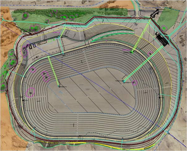
Design visualization enhancements on HCSS Aerial more realistically render the look and feel of 2D designs on the models.HCSSThe upload wizard improves the accuracy of your model by ensuring that the uploaded image set doesn’t contain duplicates and by analyzing location data and time of capture for superior detection. The upload wizard also warns you of images that do not have complete GPS information. This saves time by helping you improve accuracy and avoid reprocessing models. Other features include:
Enforced checkpoint marking to improve accuracy reports. Ground control points cannot be set as a checkpoint if they are not marked on at least two different images.>Automatic geo-reference supporting real-time kinematic (RTK) flights for accurate and consistent models.>Easy import and support of native design files, such as DXF, DWG, DGN and LandXML, for progress monitoring analytics and design overlay visualization. This eliminates the need to use CAD experts, conversion tools or data quality checks. >
Did you miss our previous article…
https://constructionosa.org/?p=109